
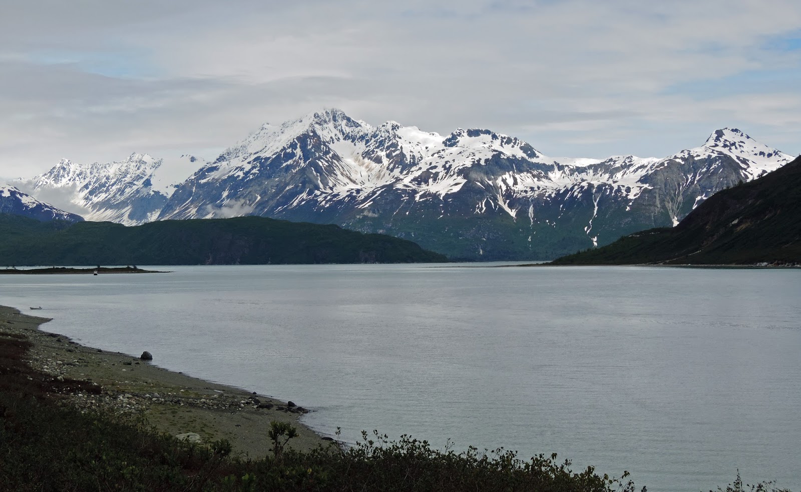
A bit of little-known history is necessary to understand this bay. There was a Little Ice Age in 1750 which caused glaciers in this area to advance, carving out valleys and a deep bay. The glaciers receded and most continue to recede. The main glacier, the Grand Pacific, has receded 65 miles, leaving a wide, deep bay running north/south with finger bays extending to the sides, which were cut by other glaciers.
John Muir first visited Glacier Bay in 1879 to find that the glaciers had receded 40 miles in the past century. Other scientists followed, studying how plant life was reintroduced to barren rock scraped by the glaciers. The scientists convinced President Coolidge to protect the area as a National Monument in 1925. Glacier Bay became a park in 1980, comprised of 3.3 million acres – ample area to keep cruisers and hikers challenged and entertained. Today, only 24 recreational boats are allowed in the Bay at any one time, and then only after the captain has been formally instructed on how to enjoy the park without encroaching on wildlife and ecosystems.

The gray wall meeting the water in the middle of this image is the Grand Pacific Glacier. For scale, a cruise ship would look tiny in front of it. The face is two miles wide. This river of ice, 34 miles long, runs down from the right and turns to meet the bay. The gray color is the granite rock that has ground away as it travels down the mountain, cutting a deeper and deeper valley. Relatively warm temperatures and the sun have melted away some of the ice, leaving the rock exposed. The seemingly small white spot on the left is another glacier, Margerie.

Margerie is a showy glacier. She runs down to the bay where the water is deep, her face calving off into a white-blue sheer wall. Margerie is a mile wide and moves 6–8 feet a day. At times, the water in front of Margerie is covered with ice pieces, known as brash ice. More thinly scattered pieces down the bay are called bergie bits. One did provide ice for our drinks for multiple days.


 |
| Margerie Glacier - Robin Roberts Photo |
One of the side bays to the south was created by the John Hopkins Glacier. The upper reaches of this bay are boat free in May and June as it is the favorite place for Harbor Seals to give birth on top of the ice flows. So, a view of John Hopkins was not possible. But, don’t despair. At the mouth of John Hopkins Bay, another glacier moves into the bay from the south.
 |
| Lamplugh Glacier |
Lamplugh is another showy glacier with an often-calving, white-blue face. It, too, meets the bay where the water is deep. It groans, creaks, and makes cracking sounds as it moves forward and loses hunks of ice to the bay. A couple more images will give a glimpse of this enormous moving mass of ice.


Lamplugh, John Hopkins, Margerie, and Grand Pacific Glaciers enter the north end of the bay within only a few miles. The fact that so many glaciers can be traveling down mountainsides in such close proximity is mind-boggling. And, such massive quantities of ice being dropped into the bay is unfathomable. Then, only a couple more miles south, there is another glacier, Reid.
Reid is a slow-moving glacier, allowing the ice to melt and exposing the crushed rock which was ground away on its run down the mountain. Although not the prettiest of the glaciers, it has many features for the cruising boater.
 |
| Reid Glacier |
Reid is a slow-moving glacier, allowing the ice to melt and exposing the crushed rock which was ground away on its run down the mountain. Although not the prettiest of the glaciers, it has many features for the cruising boater.


The water in Reid Bay is a milky white. Closer to the glacier, the water is even whiter. This phenomenon is created due to the grinding of the ice over rock, grinding some of the rock as fine as flour. Glacier flour mixes with the water and the particles are so fine and light that they stay suspended.


Not all glaciers reach to the bay. Some move down the side of a mountain and end high above sea level. One such glacier, Aurora, was spotted on a trip around Gilkie Bay. The ice face of the glacier can be seen high in the valley between the peaks. And, yes, another magnificent view of the mountain ranges that ring Glacier Bay. Most peaks near the bay are only 5,000 feet in elevation. “Only” because on a very clear day, Mount Fairweather’s peak at 15,000 feet can be seen.
 |
| Aurora Glacier |

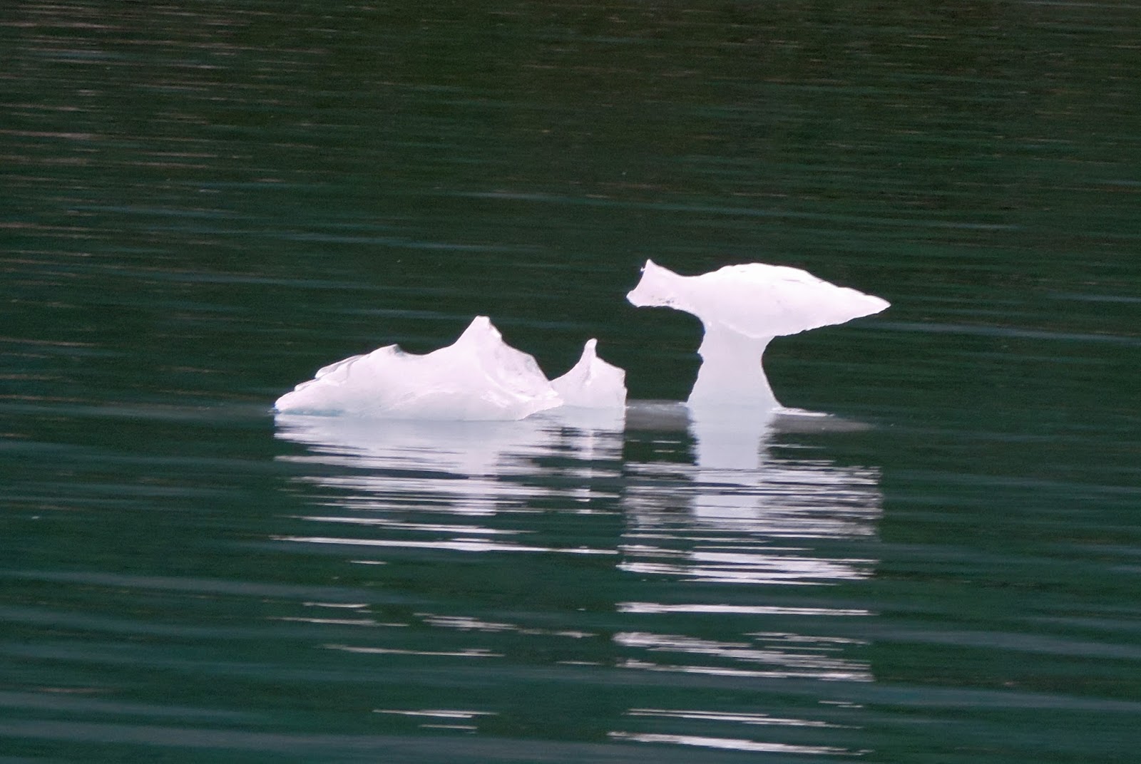
In the northern half of Glacier Bay, everyone’s eyes should be on the water for both navigation and viewing interests. Bergie bits abound. They can comprise many tons of ice which one would not like to challenge with the hull of their boat. They also exhibit nature’s ability to create sculpture in both the abstract and formal senses.

One appeared to be a Dog Fish or cartoon fish, another a sculpture of a fish out of water. All are interesting sights.

Bergie Bits also provide places for wildlife to roost – literally, if it is proper to call an eagle perched as roosting. A couple eagles were sighted on bergie bits, this one was a bit shy, choosing not to look at the camera.
Ice is the landscape of Glacier Bay. As the glaciers continue to move, they continue to shape the geography of the bay and making for an ever-changing environment. There is much artistry in nature.