This online document is a means of sharing the adventure of traveling on America's waterways with friends and family. Last Dance is continuing to take her crew to historical, natural, beautiful, and interesting places. Enjoy the ride.

Wednesday, July 26, 2017

Alaska - Glacier Bay National Park - Glaciers


A bit of little-known history is necessary to understand this bay.  There was a Little Ice Age in 1750 which caused glaciers in this area to advance, carving out valleys and a deep bay.  The glaciers receded and most continue to recede.  The main glacier, the Grand Pacific, has receded 65 miles, leaving a wide, deep bay running north/south with finger bays extending to the sides, which were cut by other glaciers.

John Muir first visited Glacier Bay in 1879 to find that the glaciers had receded 40 miles in the past century.  Other scientists followed, studying how plant life was reintroduced to barren rock scraped by the glaciers.  The scientists convinced President Coolidge to protect the area as a National Monument in 1925.  Glacier Bay became a park in 1980, comprised of 3.3 million acres – ample area to keep cruisers and hikers challenged and entertained.  Today, only 24 recreational boats are allowed in the Bay at any one time, and then only after the captain has been formally instructed on how to enjoy the park without encroaching on wildlife and ecosystems.


The gray wall meeting the water in the middle of this image is the Grand Pacific Glacier.  For scale, a cruise ship would look tiny in front of it.  The face is two miles wide. This river of ice, 34 miles long, runs down from the right and turns to meet the bay.  The gray color is the granite rock that has ground away as it travels down the mountain, cutting a deeper and deeper valley.   Relatively warm temperatures and the sun have melted away some of the ice, leaving the rock exposed.  The seemingly small white spot on the left is another glacier, Margerie. 

Margerie is a showy glacier.  She runs down to the bay where the water is deep, her face calving off into a white-blue sheer wall.  Margerie is a mile wide and moves 6–8 feet a day.  At times, the water in front of Margerie is covered with ice pieces, known as brash ice.  More thinly scattered pieces down the bay are called bergie bits.  One did provide ice for our drinks for multiple days.


The ice lasted days because it is so dense, compressed under millions of tons of snow.  When it is really dense, it takes on a blue color. 


Margerie Glacier - Robin Roberts Photo


One of the side bays to the south was created by the John Hopkins Glacier.  The upper reaches of this bay are boat free in May and June as it is the favorite place for Harbor Seals to give birth on top of the ice flows.  So, a view of John Hopkins was not possible.  But, don’t despair.  At the mouth of John Hopkins Bay, another glacier moves into the bay from the south.


Lamplugh Glacier


Lamplugh is another showy glacier with an often-calving, white-blue face.  It, too, meets the bay where the water is deep.  It groans, creaks, and makes cracking sounds as it moves forward and loses hunks of ice to the bay.  A couple more images will give a glimpse of this enormous moving mass of ice.


Lamplugh, John Hopkins, Margerie, and Grand Pacific Glaciers enter the north end of the bay within only a few miles.   The fact that so many glaciers can be traveling down mountainsides in such close proximity is mind-boggling.  And, such massive quantities of ice being dropped into the bay is unfathomable.  Then, only a couple more miles south, there is another glacier, Reid.


Reid Glacier

Reid is a slow-moving glacier, allowing the ice to melt and exposing the crushed rock which was ground away on its run down the mountain.  Although not the prettiest of the glaciers, it has many features for the cruising boater. 


 First, it has created a bay, one shallow enough in which to anchor.  (Most of the inlets and bays have depths of 100+ feet, making it impossible to securely anchor.)  As the glaciers move forward, they push a wall of rocks ahead of them, a moraine.  When they retreat, that wall becomes a shoal area, sometimes high enough to be dry land.  In this image of Reid Bay, looking back from near the glacier’s face, the small spit of land on the left is part of the moraine.  For a sense of scale, and the scale here is large, the small white dot in front of the green spit is a 49 DeFever pilothouse.

The second advantage of the Reid Glacier for cruisers is that the shoreline is dinghy landable, providing access for the crew to explore the glacier up close and personal.  Having the advantage of cruising close (well, as close as one wishes to dare the ice calves as they break off and fall into the sea) to the showy glaciers, gives those fortunate enough to cruise on a private vessel an incredible experience shared by few people.  But, at Reid, the experience can be even more intense as one can walk on the glacier, touch the glacier, peer inside the glacier.


The water in Reid Bay is a milky white.  Closer to the glacier, the water is even whiter.  This phenomenon is created due to the grinding of the ice over rock, grinding some of the rock as fine as flour.   Glacier flour mixes with the water and the particles are so fine and light that they stay suspended.


Hiking is an activity enjoyed by the Last Dance crew and the Adventures crew also.  Reid Bay’s shore access gave everyone a chance to stretch their legs and explore the landscape.  A walk along the beach reveals the many colors of granite rock the glacier has ground away, streams running across the beach from the melting snow and the waterfalls down the sides of the mountains, and the various fauna that are trying to establish themselves.


Not all glaciers reach to the bay.  Some move down the side of a mountain and end high above sea level.  One such glacier, Aurora, was spotted on a trip around Gilkie Bay.  The ice face of the glacier can be seen high in the valley between the peaks.  And, yes, another magnificent view of the mountain ranges that ring Glacier Bay.  Most peaks near the bay are only 5,000 feet in elevation.  “Only” because on a very clear day, Mount Fairweather’s peak at 15,000 feet can be seen. 

Aurora Glacier


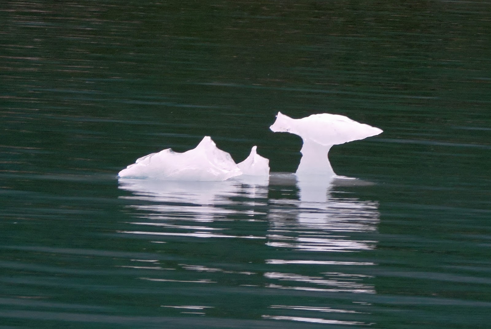
In the northern half of Glacier Bay, everyone’s eyes should be on the water for both navigation and viewing interests.  Bergie bits abound.  They can comprise many tons of ice which one would not like to challenge with the hull of their boat.  They also exhibit nature’s ability to create sculpture in both the abstract and formal senses.  


One appeared to be a Dog Fish or cartoon fish, another a sculpture of a fish out of water.  All are interesting sights.


Bergie Bits also provide places for wildlife to roost – literally, if it is proper to call an eagle perched as roosting.  A couple eagles were sighted on bergie bits, this one was a bit shy, choosing not to look at the camera.


Ice is the landscape of Glacier Bay.  As the glaciers continue to move, they continue to shape the geography of the bay and making for an ever-changing environment.  There is much artistry in nature.


Tuesday, July 25, 2017

Alaska - Glacier Bay National Park Views


There are many reasons why people travel.  At the top of the list will be to see different places and different geography.  For two Floridians, Glacier Bay is filled with very different geography.  Geography that is breathtakingly beautiful.

The mountain above seems to have a face looking to the heavens.  It is almost spiritual in nature, particularly after interacting with the Native Americans in this area.  But, that will be another story in a later post.  

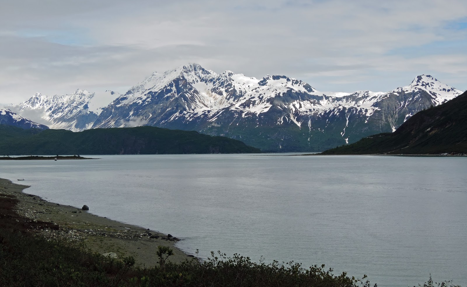
The amazing views just seem to never stop.  Move up into the various bays and a new beautiful vista reaches out and grabs your senses.  Your breathing rate increases and you must verbally exclaim your reactions to anyone in earshot.  Rather than more description, a few images are shared for your gaze.


Alaska - Glacier Bay National Park


Glacier Bay National Park offices and the park lodge are located on Bartlett Cove, just north of the small community of Gustavus.  Alaska Seaplanes landed at the Gustavus airport, where hosts Jim and Robin Roberts were waiting with a local who uses his old van as a taxi.  The image above is looking west out of the cove with a commercial fishing boat at anchor.

Below is a map of Glacier Bay, all of which lies in the national park.  For scale, the distance from Point Gustavus to the north end of the bay, at the Grand Pacific Glacier, is about 65 miles.


Adventures is a DeFever 49 Pilothouse, a well found and seaworthy craft maintained in the highest standards by Robin and Jim Roberts, our hosts for this adventure. Appropriately named craft, eh?


Adventures had cruised to Barlett Cover from their home port of Petersburg, Alaska.  The park has a dock with slips on the inside for their boats and space for cruising boats to dock alongside for short periods to take care of park business and refill water tanks.  Before moving north in Glacier Bay, boat captains are required to attend a workshop on all the rules promulgated to protect the various species of wildlife.  Note the Alaska-appropriate brown rubber boots.


What would a national park be without hiking trails?  At Bartlett Cove, a number of trails lead through the southern end of the park. The trails give a visitor a look at the land surrounding the bay.  Scientists still study the area for plant succession, the way in which plant life colonizes bare rock, eventually turning this part of Alaska into a rainforest.  Yes, rainforests are thought to be only found in the tropics by many, but a rainforest is here in Alaska, far from the tropics.


Hiking anywhere has its hazards.  It seems that National Park trails are filled with roots, serving as trip hazards.  Some trails have rocks, steep inclines, tentative footholds.  Another hazard was clearly indicated along one trail – fresh bear scat.  Stepping in it would not be pleasant, but more importantly, it indicates that a bear was on this trail recently and may still be close by.  Hiking in bear country with Jim and Robin makes the hike much safer.  They both carry bear spray.  Jim leads the group, clapping occasionally to warn bears that humans are present, while Robin takes up the rear yelling: “Hey Bear!”  


A walk through the woods is always a good catharsis for stress and brings joy to the soul.  Making a hike an educational experience is an added bonus.  Park Rangers provide guided hikes of some of the trails.  Learning the science behind the plants you are observing makes the hike more interesting and informative.  It is an ever-changing environment, as the initial plant life creates detritus that becomes soil bringing in plants and trees that require more soil for their root systems.


From lichen to fungi to mosses to ferns - the forest evolves.  The moist environment of Alaska keeps everything green.


Lichen, which can grow on bare rock, is the first plant life.  Later, ground mosses take root, followed by low growing shrubs and a series of species of trees.  One fallen tree had moss and lichen growing, a very different appearing lichen with a descriptive name – Leprechaun Vomit.


Among the first low growing plants to establish themselves in the more open, sunny areas are blueberries, beach strawberries, and false dogwood.  The first two, including the beach strawberry at right, provide food for wildlife and hikers.


A number of critters were spotted along the trails, the most common were the squirrels.


The conifer trees have a unique way of providing food and housing for the squirrels.  They pull the cones from the trees, tear off the individual scales of the cone, eat the tender part, and toss the remainder which pile up under the trees.  The squirrels then dig burrows in these piles for a well insulated home.

A walk in the woods is so much more than just a walk.


Saturday, July 22, 2017

Alaska - Flying Across the Continent


Flying was a grand event in our recent history.  Passengers dressed in their best, were treated with the utmost dignity, and fine food was served.  Most people do not find commercial air travel fun anymore, with body searches, long lines, and being herded into very tight seats like cattle.

The trip to Alaska for the native Floridians was very interesting, however.  Just the views from the planes provided great interest.  In the photo above, taken from the waiting area of the SeaTac airport near Seattle, a snow-covered mountain range was evident across the airport runways.  Alaska Air was the chosen transportation for the trip.  Interestingly, it was apparent that over half the flights in and out of SeaTac were Alaska Air flights.


Fortunately, clear skies allowed views of some beautiful lands and many peaks covered in snow.  In this shot, the 737 banks for the approach into Juneau.


Many towns in Southeastern Alaska are on islands or mainland areas that have no roads connecting them to highways.  Airplane or boat is the only means of travel to these towns.  Alaska Seaplanes began with float planes that landed on the water.  More towns now have paved airports, so more wheeled planes are now part of the fleet.  This Caravan provided transportation from Juneau to the mainland town of Gustavis, close to the park headquarters.


People are loaded in the front of the airplane, including the copilot seat - waste no space.


The only way to get stuff to places in SE Alaska is also boat or plane.  The back half of the plane was loaded with cargo.  The cargo desk for Alaska Seaplanes was as large and equally staffed at the passenger counter.  Go to the big city of Juneau to shop and you have to fly your groceries back home.


Back to the beauty of flying in Alaska.  A view from the Caravan across the Juneau airport gives a glimpse of the Mendenhall Glacier moving down the mountain valley.  More bold vistas at the airport.  The airport has both paved runways and a water runway with docks along both sides.  Travel by float plane is still the only method of access to many communities.

Yes, flying can still be enjoyable.