This online document is a means of sharing the adventure of traveling on America's waterways with friends and family. Last Dance is continuing to take her crew to historical, natural, beautiful, and interesting places. Enjoy the ride.

Monday, August 29, 2016

Georgian Bay - Navigation


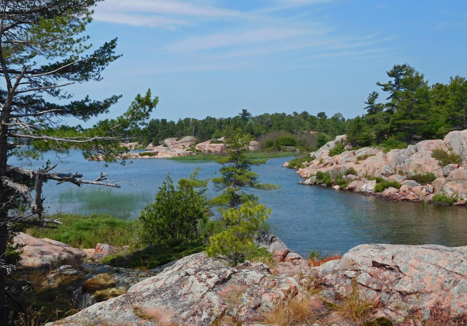
Navigation of the waters in Georgian Bay is sufficiently challenging to require full attention from skipper and crew.  Fortunately, Canada publishes sets of very accurate paper charts, though in an unusual format of long, skinny folded sheets where it seems north is never up.  The electronic charts above show Last Dance entering Potato Channel, one of the two passages between the end of the Trent Severn Canal and the beginning of the Georgian Bay.  Looking ahead of the boat the water looks wide.  Checking the chart shows that while the water is wide, the places where the water is deep are few.  On most charts, where the water is indicated in blue, it is shallow.  Where it is marked white, it is deeper.  In the zoomed-in chart on the left, actual depths can be seen.  The asterisks scattered all through this view indicate rocks just under the surface.


To get through the middle section of the channel, a hard 90° turn to port, where marker cannot be seen, is required.  Then a short channel leads to a hard 90° turn to starboard, seen ahead in this image.


Not much room to squeeze a beamy boat through between this pair of markers and boats do not make square turns well.  But, at least the Coast Guard has marked this channel.  North Channel has no marked channels.


Made it, although the momentum made the stern swing a bit wide on exit.  An interesting story happened in this channel a few years ago.  A Grand Banks was negotiating the channel, right in the middle of the markers, when it hit an underwater obstruction quite hard.  The boat's momentum pushed the boat over the obstruction and back into deep water with a damaged keel and bent props.  This happened early in the season.  The skipper called the Coast Guard to report the problem, which they promptly investigated.  A full-sized van was found with a groove through the roof created by the keel of the Grand Banks.  Over the winter, someone had been ice fishing, the ice got thin and their van fell through.  One would have to carefully craft their words to convince the insurance company that you were in the channel when you damaged your boat hitting an automobile.


Another marker system used by the Canadian Coast Guard is to place red triangles and green squares on islands and land alongside the channel.  Sometimes the land is a rock barely underwater.  One advantage of these markers is that they are permanent.  The floating markers have to be removed before winter sets in and the bay waters freeze, then reset the next spring.  In this photo, there are three of the large, permanent markers visible, 2 reds and one green.


In case you missed them, arrows have been drawn to indicate locations.  Heading north and west in the main channel of Georgian Bay, red markers are passed on the right (starboard) side of the boat, and green markers on the left (port) side of the boat.  This sometimes changes when taking a side channel.  A big reason to pay close attention to those paper charts.  This one is an easy one - just keep the reds on the right, green on the left, and pass through the middle of the water ahead.


Like this, right?


 Surveying the entire area ahead of the boat is important, even critical in this case.  Behind the rock on the left is a floating red marker.  The marked channel passes to the left of this marker.  The floating red should be on the right (starboard) side of the boat.  Boats with more than a 3' draft taking a straight route through this area find themselves hard aground.  So the answer to the question: "Like this, right?" is "Wrong!"


A more circuitous route is necessary to avoid finding underwater rocks.  In 2016, with water levels being higher due to heavy snow falls the two previous winters, some deeper draft boats might have gotten away with a mistake here.  In years with low water levels, even small boats would pay the price.


Another navigational aide is range markers, used in long, narrow channels to keep the boat aligned in the center of the channel.  Byng Inlet was a large shipping port and the range markers are large and obvious to guide ships through the deepest part of the channels and into the narrow inlet.  A short one is in front and a taller one in back.  These are very rare to have lights, almost all are just painted markers.  In this shot, the front marker is to the right, indicating that the boat is too far to the left.  A turn to the right (starboard) is needed to line the markers up.


Now, the boat is too far right and a correction to the left is required.  With no range marker and only a red and green markers in the water, a boat a long distance off can be pointing to the center of the two markers and be far off the channel to the right or left.


Since range markers are for long channels, they are far away.  You must know they are there and look for them - another reason to study the paper charts.  Binoculars are required.  The above two images, with the red-lighted range markers, were made with a long telephoto lens for illustration purposes.  This image contains the third set of range markers for Byng Inlet (there are multiple turns to get into the harbor and multiple sets of range markers).  Less of a telephoto was used in this image.  See the range markers ahead of the boat?  They are a bit to the right of center.  To let mariners know they are looking at a different set of markers, they are painted a different color and have that color light.  Yes, green might not be the best color for makers in the trees.

The navigational challenges are one of the factors that makes travel on the water interesting, and sometimes exciting.  The crew has to be watchful at all times, keeping an eye on the waters and the charts (paper and electronic) to ensure a safe passage.


Saturday, August 27, 2016

Gerogian Bay - Thomas Bay & Chickanishing River


The area of the mainland between the west end of Collins Inlet and the village of Killarney has a number of bays cut into the rock.  One of them, Thomas Bay, is deep enough for anchoring and has pink granite ridges providing protection on three sides and islands lie in the mouth of the bay giving protection to the south. Thomas Bay has been a favorite of the Last Dance crew due to its beauty, good hiking, protection from wind and waves, and solitude.


The first image is looking north into the bay.  This image is of Last Dance leaving the bay, headed SSE, showing one of the islands that protects the bay to the south.  There is large water and large fetch to the south - the next land mass to the south is Northern Michigan, across Georgian Bay and Lake Huron.  The narrow entrance into the bay can also be seen here.  There are rocks under water on the left side of this cut, and rocks scattered in the waters past the bay opening, requiring a circuitous route to keep the boat from running aground, which with a rock bottom would cause considerable damage.  There is a good point to the many rocks - most boaters will not attempt to enter Thomas Bay due to the rocks, which results in few boats at anchor and a more private anchorage.


The granite rock surrounding the bay is covered with an open forest, perfect for hiking, and exploring. The ridge on the west side of the bay is steep, rising to 125 feet over the water in a short distance, a more challenging climb.  A peek through the trees into the bay reveals Last Dance at anchor.


The rock and flora change, creating a seemingly endless number of beautiful views and vistas.  Hiking and primitive camping is a major activity in Killarney Provincial Park with visitors often using kayaks and tents for transportation and housing.  This crew enjoys the great hiking opportunities, but appreciates the comforts of home provided by a trawler and the ability to handle rougher waters.


To the east of Thomas Bay lies Georges Bay.  It, too, is a beautiful spot, but not one appropriate for anchoring.  There are many rocks in this bay - the ones above the water are called islands, the ones under the water are trouble waiting to happen.  Anchoring a boat takes a lot of space.  It's not like parking a car.  The anchor must be set away from the boat so the anchor is pulled at a slight angle, setting it in the bottom.  If the rode (the line attaching the anchor to the boat) is 80' and the boat is 40', the swing radius is 120'.  The boat could be anywhere inside a 240' diameter circle. As the wind changes direction, the boat moves to another place.  Dinghy exploration is the way to go here.


Hiking islands brings new views and new discoveries.  How did these rocks get formed into the various shapes and how did this hole get whittled out?  Oh, when hiking Georgian Bay, you should always have a container with you as you never know when you will stumble onto a blueberry patch.


Killarney Provincial Park is a large park - 187 square miles.  It is mostly left in a natural state, but there are a few improved areas.  On the Chikanishing River, there is a boat launch and interpretive hiking trail.  Some of the kayak campers begin their expedition from here.  The mouth of the river, quite hidden in the shoreline, lies between Thomas Bay and Keyhole Island.


Gunkholer, a sailboat from Michigan, was also anchored in Thomas Bay.  Anchorages had been shared and friendships formed in North Channel on the 2014 voyage.  Planned over drinks on the boat one evening, a trip up the Chickanshing was undertaken.  It is prudent to not take the dinghy farther from the mother ship than one is willing to row back.  Having a buddy boat for the trip raised the comfort level.


Chris and Diane, the crew aboard Gunkholer, made for great hiking buddies.  Their cruising philosophy closely matches that of the Last Dance crew.  Gunkholer is a boating term describing cruisers who meander from place to place anchoring in small coves.  The Chickanishing trail was more challenging than expected, scenic, and educational with many historic markers.  The image below is a view off the trail with the western end of Collins Inlet to the left.  The photos below provide a small sample of the vistas off this trail and will end this post and descriptions of places along Georgian Bay.


Thursday, August 25, 2016

Gerogian Bay - Collins Inlet


Collins Inlet cuts through a section of the Canadian Shield cutting off a piece of the mainland known as Phillip Edward Island.  The land on the right in this image is mainland and the land on the left, island.  With the exception of a few small areas, all of Phillip Edward Island is crown land, open for hiking and camping.  Collins Inlet cut connects Beaverstone Bay and Killarney.  If it were a dead-end gorge, it could be described as a fjord, so to be geologically correct, it is fjord-like.  Whatever, it is a passage with amazing natural beauty created on a pallet of granite ridges.


Gerogian Bay - Beaverstone Bay


Beaverstone Bay is located at the east end of Collins Inlet, just off the large waters of Georgian Bay.  A group of islands in this small bay create a few protected anchorages.  Most of the land surrounding the bay is public.  Land here continues to be pink granite rocks covered with a few trees and other plants.


Granite rock can be almost vertical in some places, in others the rock slopes to the water's edge providing good dinghy landing access.


Public lands and easy shore access provide opportunities for hiking, exploring, and berry picking.  Everyone gets into the action.


For one crew member, hiking is not considered sufficient exercise.  A few minutes of turbo, running in large circles at full speed, helps fulfill the need.


Beaverstone Bay is reported to have some bass lurking under the waters.  A few decided that the lures trolled behind Rubber Duck looked enough like fish to strike.  This little one was released back to the water to grow larger for another day.  Beaverstone proved to be another of the beautiful and secluded spots among the 30,000 Islands in Georgian Bay area of Lake Huron.


On the journey along the Georgian Bay shore toward Beaverstone Bay and Collins Inlet, a view of the distant mountains become closer and clearer.  This ridge is called the Blue Ridge even though it is entirely white quartz.  It forms the northern edge of Baie Fine and Lake Topaz lies along the top.

Tuesday, August 23, 2016

Gerogian Bay - Bad River


Bad River is one of the many outlets into Georgian Bay by which the French River flows.  The area has many cuts both north/south and east/west where water flows, often quite fast producing rapids.  This area is also known for its fishing and a fishing lodge is located on one of the cuts, the only building in many miles.  There is a story about the rock wall in the background of this shot, the reason it begins this post, even though it is not a colorful or bright image due to the heavy overcast on this day.


On the boat, in the anchorage, there is no cell phone signal.  This location is far from any civilization and also from the Trans Canada Highway which has cell towers along its length.  So, extra altitude was needed to get a cell phone signal.  The pink granite wall had the highest altitude in the area, but was fairly vertical.  The first section was only a moderate challenge, but the second half could only be ascended by climbing up an angled crack in its face, often narrower than a shoe.


Not all of the Last Dance crew thought a climb up the face of the rock wall was a good idea.  So, instead of climbing, warnings of impending doom that could befall one was constantly shared.  Fortunately, the worst case scenario did not occur and all the crew made it back to the bottom of the wall and into the dinghy.


Another advantage of increased altitude was the view that was available.  This is a view to the south, along one of the main Bad River channels, into Georgia Bay.  Even on this very gray day, the beauty is evident.


The best known rapid in the Bad River is Devils Door, which provides the connector from the anchorage area to all the other cuts, river channels, bays, and rapids.  At normal water levels, the drop from the upper level to the lower level, which is at the height of Georgian Bay and Lake Huron, is about 3 feet, resulting in a fast running and steep rapid.  Those with high horse power dinghies can run up the rapid and access all the many channels beyond.  Although, sometimes when the rapid is high, the high horsepower dinghies push the bow so high that it comes over the stern and the dinghy is upside down.  In 2016, the water level was 2 feet 9 inches above normal, reducing the fall at the Devils Door to about 6 inches.  Little enough current that the 4 hp outboard powering the Last Dance dinghy, Rubber Duck, was able to make it up stream.


Even with the higher water levels, the drop at some of the rapids was still large.  This is a cut that fishing guides use to come back down river.  The boats often leap airborne as they cross this drop at high speed.


There is not a way to get up river, to the many bays and cuts rumored to be filled with fish, unless one takes a boat up one of the rapids.  This particular rapid is not one of the ones that is recommended.


Other rapids are even smaller in width and depth.  There are many cuts running north/south through which the Bad River flows.  Knowing which one might provide the access to the upper river waters is key to safe passage.


One of the joys of cruising is the wonderful people you meet along the way.  Among new Canadian friends is Bruce Rawlerson.  His knowledge of the waters, many successful years fishing, and his dinghy with a 15 hp outboard, made the trip up the river and up a set of rapids possible.  A quite thrilling ride.  A fishing lesson ensued, but it seemed that all the fish were on Bruce's side of the dinghy.  Here a small Pike provided a sporting fight and a delicious dinner.   The best lesson was on filleting a Pike - into five fillets, not two.  The Pike has a backbone with ribs extending in a Y pattern.  Fillet them incorrectly and you wind up with many, many small bones in the fillets.


One of the cuts leading upriver, one farther away from the anchorage, reportedly was navigatable by dinghy with more spectacular rapids.  A higher water line that occurs during spring runoff can be seen.


There were many narrow sections that limited travel to smaller beam boats.


And, there was one long, narrow section that lacked depth, causing rapidly moving water that taxed the horsepower of Rubber Duck to make it upstream.  Of course, running back downstream was accomplished quickly.


The next section of rapids stopped all travel.  This rapid is much too shallow and rapid for transit.  A kayak or canoe could be portaged at this point to access the upper river, but would have been tough to impossible to get up the previous rapid.  There are many good reasons that canoe expeditions in this area always begin farther upstream and the canoers paddle downstream.


The ridges running north/south are the most common geological feature in this area.  With some east/west cuts thrown in, these ridges become sectioned and turn into islands.


The Bad River area offers much for outdoor recreation.  The ridges have many hiking and exploring opportunities, running through beautiful natural habitats.


The area is also known for having many and prolific blueberry bushes.  Oh, the flavor contained in wild blueberries cannot be approached by their larger, cultivated cousins.


Fishing is not only limited to those moving by boat.  Shoreside casting is always an option.

Canadian waters offer different anchoring techniques, including ones not using an anchor.  Where the rock on the shoreline is vertical, it often continues so under the water.  Deep water right next to shore allows a boat to tie up beam to the shore.  Here, three friends have joined in a raft.  Being securely tied to a rock has advantages.  But, like most things in life, there are also disadvantages.  Visits from wildlife have occurred, including bears coming aboard to rifle through cabinets for food.