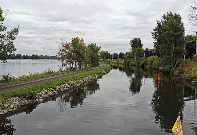
The Richelieu River flows from Lake Champlain north to the St. Lawrence River. A portion of the river was made navigable in the early 19th century by the construction of the Chambly Canal, which parallels the Richelieu River rapids. Last Dance's journey was upstream, south on the river heading toward Lake Champlain.
The ride up the Richelieu revealed that one portion is also used as an airport runway. In the northern waters, it is somewhat common that the waterways are shared with aircraft.
After the planes land, they are pulled ashore onto the airport property by a towmotor. The use of the river as a runway saves a lot of paving of wooded property.
About halfway up the river lies the town of Chambly, the beginning of the Chambly Canal. The first lock is actually two locks, constructed in a stepped fashion. This image is looking into the first lock chamber, which is currently empty, sitting at the river level. Boats are raised to the top of this chamber, then the doors open to the upper chamber, where they are again lifted to the height of the upper doors. The Chambly Canal is the smallest of any of the canals. The lock chambers can only fit two boats of the size of Last Dance. The entire canal is 7.5 miles long with 9 locks.
The upper chamber of Lock 1, looking north at the river.
The Chambly Canal was completed in 1843, about a decade later than the Rideau Canal. It is also a hand operated system requiring lockstaff to hand crank the gates that allow water into and out of the lock chambers, and opening the large wooden lock doors. The difference a decade makes with better tooling producing higher quality and more modern machinery is apparent.
The Chambly Lock system is operated by Parks Canada, which achieves their goal of maintaining the locks and surrounding property as an accurate historic park. This is the lockmaster's station, where they would maintain watch. All of the lock property is manicured and complimented with trees and landscaping. The lockstaff are most welcoming, helpful, and friendly. The beautiful surroundings and quality staff make the transit of the Chambly Canal a pleasurable adventure.
Just above Lock 1, the park along the lock wall provides a quiet setting between the 18th century town and the 17th century French fort. A couple days were spent here, providing a convenient spot to explore the history of the area and sample a few of the quality restaurants.
In the old downtown, many historic houses have been renovated and maintained as residences. A walk through town is an exhibit of historic architecture.
A new condo project in town has been designed in keeping with the architectural style found in many of the historic homes.
On the other side of the canal lies Fort Chambly, built by the French in 1711 to provide protection to the French Canada settlement. It is right along the edge of the Richelieu River at the Richelieu Rapids. It is operated by Parks Canada as a historic site.
When the French built Fort Chambly, they also built quarters for the officers stationed there. A couple of the officers' quarters have gone to private hands and been renovated into magnificent homes.
Behind the houses along this street lie the Richelieuu Rapids, which in this image are somewhat calm. Large rain events and high waters bring steeper and raging waters. The need for a canal to make these waters navigable, particularly in an upstream direction, become obvious when looking at the rapids.
The land between the Chambly Canal and the Richelieu River near the fort is filled with beautiful, old homes sited in luscious, mature landscapes.
At some points along the canal, the land separating the Chambly from the Richelieu is only a thin strip. At other locations, the land is wide enough for neighborhoods of homes. The length of the canal has a popular walking/biking trail.
The narrowness of the canal can be seen in this image of a swing bridge. Parks Canada, in keeping with the historic nature of the canal, does not use radios for communication. Boats pull up to the swing bridge, talk(in a projected voice) to the staff member on the bridge, and he/she then opens the bridge. The small operator's station can be seen in the third image.
Another of the bridges along the canal was a hinged lift bridge of a quite different design. The floating dock was needed to moor the boat while waiting for the staff member to come from a different location to operate the bridge. The pace along the canal is leisurely.
 |
| Photo (c) marinas.com |
Lock 9, the southern terminus of the Chambly Canal, is located in the middle of the town of St.-Jean-Sur-Richelieu. St. Jean is an active little town, undergoing a rebuilding effort, with many restaurants and an amazing French Bakery.
The newest building project in St. Jean was a central downtown park. The sculptor was finishing the installation of his contribution to the park.


