The area of the mainland between the west end of Collins Inlet and the village of Killarney has a number of bays cut into the rock. One of them, Thomas Bay, is deep enough for anchoring and has pink granite ridges providing protection on three sides and islands lie in the mouth of the bay giving protection to the south. Thomas Bay has been a favorite of the Last Dance crew due to its beauty, good hiking, protection from wind and waves, and solitude.

The first image is looking north into the bay. This image is of Last Dance leaving the bay, headed SSE, showing one of the islands that protects the bay to the south. There is large water and large fetch to the south - the next land mass to the south is Northern Michigan, across Georgian Bay and Lake Huron. The narrow entrance into the bay can also be seen here. There are rocks under water on the left side of this cut, and rocks scattered in the waters past the bay opening, requiring a circuitous route to keep the boat from running aground, which with a rock bottom would cause considerable damage. There is a good point to the many rocks - most boaters will not attempt to enter Thomas Bay due to the rocks, which results in few boats at anchor and a more private anchorage.

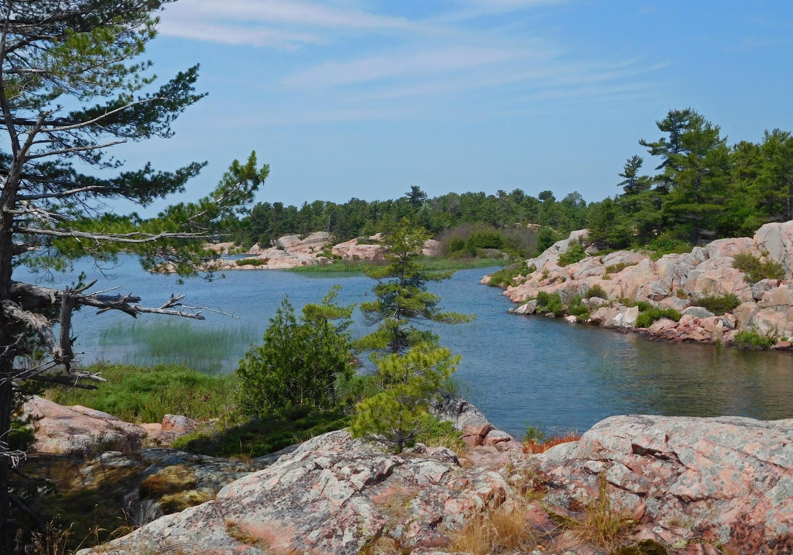
The granite rock surrounding the bay is covered with an open forest, perfect for hiking, and exploring. The ridge on the west side of the bay is steep, rising to 125 feet over the water in a short distance, a more challenging climb. A peek through the trees into the bay reveals Last Dance at anchor.

The rock and flora change, creating a seemingly endless number of beautiful views and vistas. Hiking and primitive camping is a major activity in Killarney Provincial Park with visitors often using kayaks and tents for transportation and housing. This crew enjoys the great hiking opportunities, but appreciates the comforts of home provided by a trawler and the ability to handle rougher waters.

To the east of Thomas Bay lies Georges Bay. It, too, is a beautiful spot, but not one appropriate for anchoring. There are many rocks in this bay - the ones above the water are called islands, the ones under the water are trouble waiting to happen. Anchoring a boat takes a lot of space. It's not like parking a car. The anchor must be set away from the boat so the anchor is pulled at a slight angle, setting it in the bottom. If the rode (the line attaching the anchor to the boat) is 80' and the boat is 40', the swing radius is 120'. The boat could be anywhere inside a 240' diameter circle. As the wind changes direction, the boat moves to another place. Dinghy exploration is the way to go here.

Hiking islands brings new views and new discoveries. How did these rocks get formed into the various shapes and how did this hole get whittled out? Oh, when hiking Georgian Bay, you should always have a container with you as you never know when you will stumble onto a blueberry patch.

Killarney Provincial Park is a large park - 187 square miles. It is mostly left in a natural state, but there are a few improved areas. On the Chikanishing River, there is a boat launch and interpretive hiking trail. Some of the kayak campers begin their expedition from here. The mouth of the river, quite hidden in the shoreline, lies between Thomas Bay and Keyhole Island.

Gunkholer, a sailboat from Michigan, was also anchored in Thomas Bay. Anchorages had been shared and friendships formed in North Channel on the 2014 voyage. Planned over drinks on the boat one evening, a trip up the Chickanshing was undertaken. It is prudent to not take the dinghy farther from the mother ship than one is willing to row back. Having a buddy boat for the trip raised the comfort level.


Chris and Diane, the crew aboard Gunkholer, made for great hiking buddies. Their cruising philosophy closely matches that of the Last Dance crew. Gunkholer is a boating term describing cruisers who meander from place to place anchoring in small coves. The Chickanishing trail was more challenging than expected, scenic, and educational with many historic markers. The image below is a view off the trail with the western end of Collins Inlet to the left. The photos below provide a small sample of the vistas off this trail and will end this post and descriptions of places along Georgian Bay.